

Getting lost in a car can be a fairly simple thing to do and I know we have all been lost at times, but when a pilot is flying in a helicopter there are no signs to tell them where to go, so how do pilots stop from getting lost?
Helicopters can be flown with and without GPS. GPS units can be portable and mounted in a cradle, permanently installed in the cockpit, or installed as part of a sophisticated automatic navigation and flight control system. Small handheld GPS and iPads are very popular in smaller helicopters.
Over the last 20 years, the use of dedicated aviation GPS technology has meant that any pilot can easily mount a GPS in their helicopter and instantly keep track of where they are going. Having flown for years without the use of a GPS I can tell you that having one in the cockpit really helps offload some mental workload!
If you wish to find out more about the GPS used in helicopters then please read on…
Are there Different Types of Helicopter GPS?
There are 4 main types of GPS used in helicopters. A Portable GPS that clicks into a mounting cradle, an aviation GPS mounted into a permanent location, an iPad running aviation software, and a complete aircraft avionics system that integrates many aircraft systems into the cockpit.
Each type of GPS system has its pros and cons and the more complex the GPS system, the more expensive it becomes to have it installed into the aircraft.
Here are the 4 main types of helicopter GPS systems:
Portable GPS
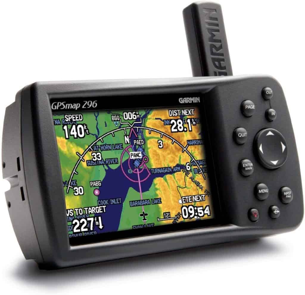
This is a GPS that runs dedicated aviation software. They can be a simple GPS showing just your Lat/Long position, ground speed, distance to the next waypoint, etc, or can have a built-in moving map to really increase the pilot’s situational awareness.
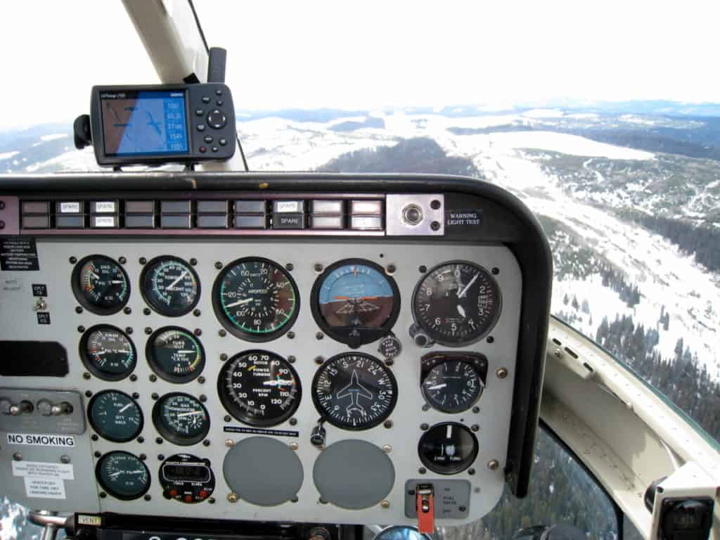
These portable units mount into the aircraft via cradles with suction cups to stick them to windows or can have a cradle mounted to the top of the instrument panel as you can see in the above photo. This was how it was mounted in the Bell 206 I used to fly many moons ago.
When a cradle is secured into the cockpit a power supply cable is usually made available to plug into a power outlet in the aircraft if the engineers have been kind enough to install one. If no power outlet is available the pilot must be vigilant of the GPS’s battery life!
These types of GPS were once the most popular and cheapest options for private pilots, aircraft owners, and pilots who rent or work in various aircraft as their portability allows the most flexibility when moving between aircraft.
The other great feature of these types of GPS is that a flight can be planned on the computer using the manufacturer’s software and then easily downloaded to the GPS. The GPS can then be taken from the office, placed into the aircraft and the flight commenced with ease!
Permanently Mounted GPS
The next step up for helicopter GPS is to be permanently mounted into the aircraft. Many companies do this as it then ensures their pilots have a working GPS, but as you can imagine it takes a lot more time, effort, and cost to do this.
When someone buys a personal helicopter this is a very popular choice as it is then always part of the helicopter. It will be hard-wired so it never has to run off battery and the installations into the instrument panel mean there is no GPS sitting on top of the panel or stuck to a window blocking the pilot’s view.
Join My Newsletter & Get Great Tips, Information and Experiences To Help You Become a Superb Pilot!
These types of installations are slowly becoming less popular as they require a lot of empty space on the panel to be installed, they require installation by a qualified avionics engineer and they require a laptop to be brought out to the aircraft to install a pre-planned flight plan onto them.
With the advance in glass cockpits and iPads, the effort and cost required to complete this type of installation are not justified anymore.
iPad
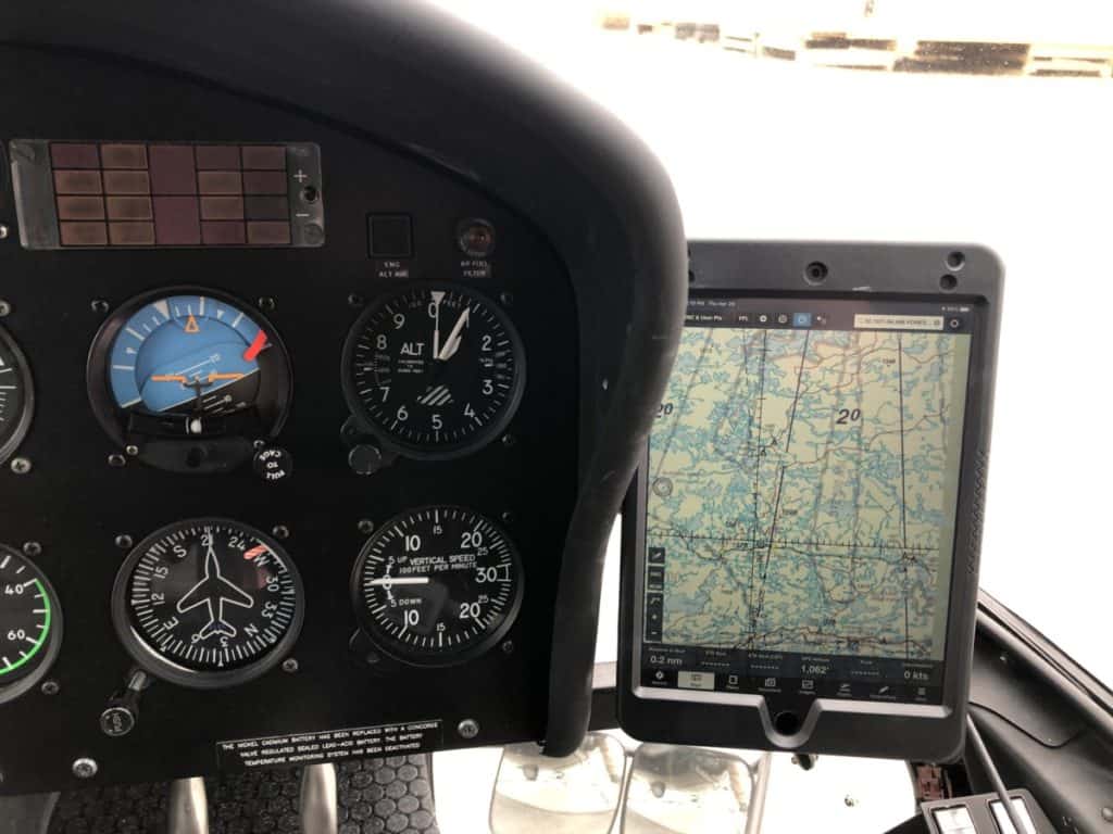
By far the most popular GPS option available to private pilots, commercial pilots, and many commercial aviation companies is an iPad Mini running an aviation-based App like ForeFlight or Garmin Pilot.
These are very powerful apps that not only turn any iPad into a fully-functioning aviation GPS, but also pack all of the flight planning, weight & Balance, and aircraft documentation into one device.
This is the system that I have been personally using for the last 10 years and it is a great way to navigate. Many companies now provide pilots with their own personal iPad and place mounting systems into their aircraft to allow the iPads to be easily installed and permanently powered.
If you wish to see just how easy they work check out this video:
If you wish to find out more about the PIVOT mounting system you can find the whole range Here at Flyboys.com
Also, be sure to use the code pilotteacher for 10% off!
The only cons to using iPads in the cockpit are they can take up a lot of room and they will stop working if they get too hot or too cold, but by looking after them they are one heck of a great tool for any pilot!
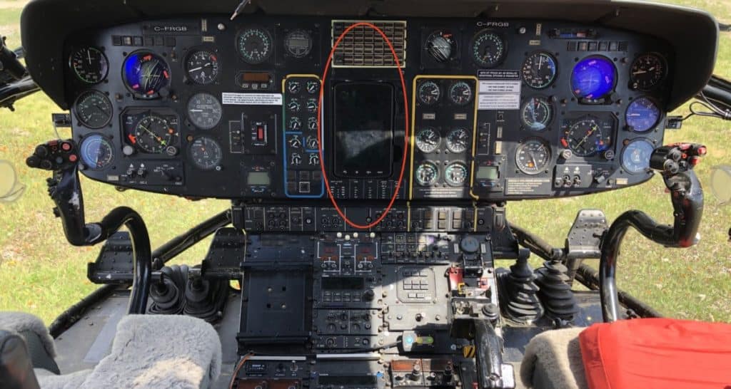
FMS – Flight Management System
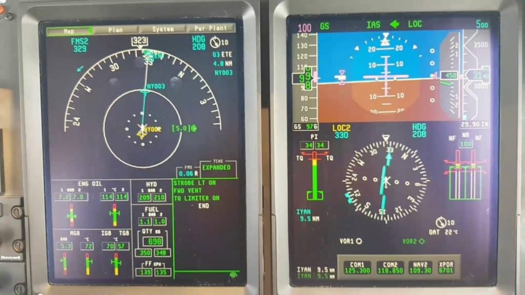
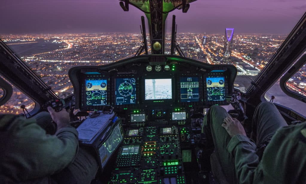
Most modern helicopters are now becoming very complex machines. When all-weather, day, and night capabilities are required then a GPS system that is approved to fly under IFR (Instrument Flight Rules) is the only way to go.
Instrument Flight Rules is a set of rules and protocols that allows pilots to fly the aircraft without any visual reference outside of the aircraft. To be able to do this, the pilots must fly using sole visual reference to its instruments and because of this, the GPS system must be designed, installed, and approved for IFR flight. These systems are not cheap and the previously mentioned type of GPS is not IFR certified.
The GPS system/s on these helicopters is just part of a complete suite of aircraft functions that are usually integrated with the pilot displays, communication systems, navigation systems, engine, and aircraft control systems, automatic flight control systems, and many more.
An example of this is the Sikorsky S92 which is a very popular offshore transport helicopter that is certified to fly in some of the worst weather imaginable.
The planned flight routing and information are inputted into the system by the pilots using a keypad and by using an onboard aviation and navigation database the GPS places the information on the pilot screens along with a plethora of other data. These systems are most commonly found on helicopters over 5 seats and will cost you well over several million dollars!
Having flown in these types of helicopters I can tell you it is remarkable how well they can fly and how little the pilot actually has to do!
Can You Use a GPS in a Helicopter?
Any GPS can be used in a helicopter providing it can get a reliable signal from the satellites. Using or mounting the GPS by a window or connecting it to a fuselage-mounted antenna will help with signal reception. GPS does not affect any helicopter flight control or navigation systems.
Many helicopter cabins are made of aluminum, fiberglass, or composites which can block the satellite signal to those passengers sitting in the cabin. When I have been flying with field technicians they will either bring a small GPS they can hold by a window or will mount a booster antenna to the window via a suction cup and then connect their GPS to that.
For any passengers sitting in the middle seat/s of a helicopter in the back of the cabin, it can be difficult, to almost impossible to get a reliable satellite signal because of the cabin roof blocking the signal.
Passengers have sometimes asked if their GPS will affect the helicopter and the answer is no. I have yet to find ANY device that has affected my helicopter systems while in flight and the GPS is one of them.
How Do Helicopters Navigate Without GPS?
To navigate a helicopter without a GPS the pilot needs to either be familiar with the area over which they are flying, use a map, or fly headings with timed legs. These were the main methods of navigating before GPS and every pilot gets taught these techniques in flight school.
Being able to fly any aircraft without the need for GPS is a fundamental flying skill. Like all pieces of technology, a GPS can stop working at any time, and if it is the pilots’ only way of knowing where they are they will become lost very quickly. It is this reason why all pilots are taught the fundamentals of air navigation during their training and the use of a GPS in a basic training aircraft is usually forbidden.
The main navigation technique used by pilots without a GPS is called ‘Dead Reckoning’. This is the method of looking out of the aircraft window and referencing landmarks and topographical features they see, to a map they have open on their lap.
Rivers, roads, towns, coastlines, powerlines, hills/mountains, rail lines, lakes, and airports are all shown on an aviation map, also commonly known as a Chart. By flying along a set path the pilot should see landmarks in the same location they are on the map for their chosen route.
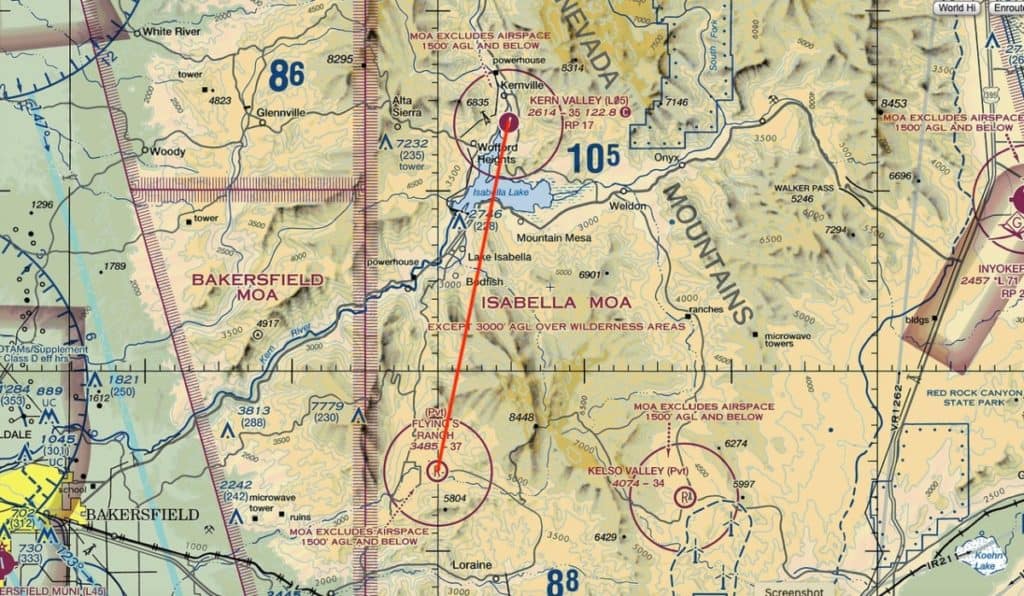
For example, a pilot flying a helicopter from Flying S Ranch, north to Kern Vally airport:
- Upon takeoff and flying on a NNE heading they should have a road on their left and a mountain peak on their right
- They will then cross a small stream/river and have the towns of Bodfish and Lake Isabella on their left
- Just before crossing Lake Isabella they should see a tower that is 228 feet tall on their left
- Kern Valley Airport should then be located at the northern tip of Isabella Lake
By flying and referencing the landmarks they see this is how a pilot can navigate the easiest without a GPS. If a pilot begins to see landmarks that they cannot find on the map they make have become lost. It is at this point they need to find where they are on the map and reorientate themselves to get back on the correct course to ensure they reach their destination.
Further Reading
If you found this article helpful here are a few more I can suggest:
- Aircraft & Pilot Call Signs: What Are They Really For?
- What Do Pilots Use iPads For? More Than You Think!
- Identifying A Runway – How Do Pilots Get It Right?
- How Do Pilots See At Night? A Pilot Tells All!
- Aviation Weather Information: How do Pilots Get It?